
Page published: 29 January 2021
As reported in My Postscript to the blog post, on this page we have the script of the commentary I was to deliver to passengers aboard Liberty Belle on the day that I stood in for Steve while he attended a friend's wedding.
It was sent a ".doc" file and contained only the text presented here. Subject to screen size, and font, the formatting of the original document has been preserved, but this will be disrupted by the photos and captions I have added.
 The Script for the Commentary
(After Lincoln bridge:)
Good afternoon, and welcome aboard Liberty Belle, for a cruise along the River Great Ouse.
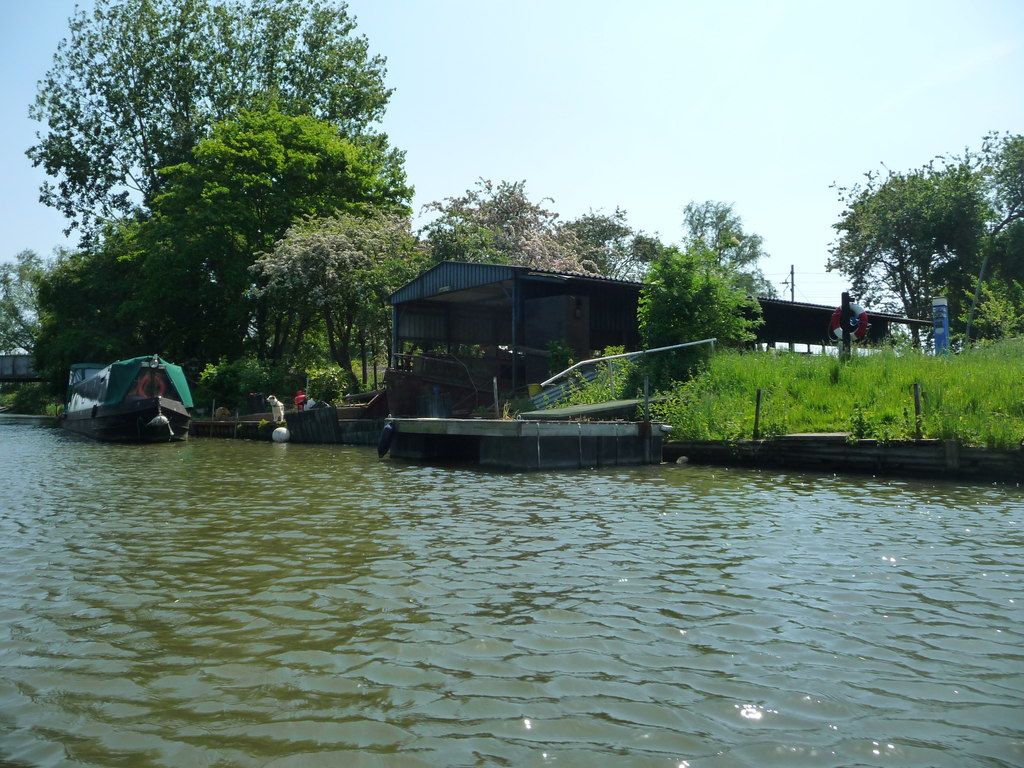
The name of the city, Ely, comes from the Saxon word Elig, meaning ‘eel island’, after the large number of eels that used to be caught from the river here. A local man still lays his nets along the river bed from time to time to catch the eels, but there are fewer of them to be found these days. The part of Ely over to our right here is known as Babylon, and until the 1960s, when the bridge behind us was built, it had no road access at all. Indeed, the boat safety examiner, who lives a little further on the right hand side, still has to use a small boat to get to and from his home.
©: Christine Johnstone (cc-by-sa/2.0)
This is the area on the right, known as Babylon. Maybe my memory is fading but it appears that the home of the Boat Safety Examiner has been gone awhile, to be replaced by a covered boat dock.
* * * * *
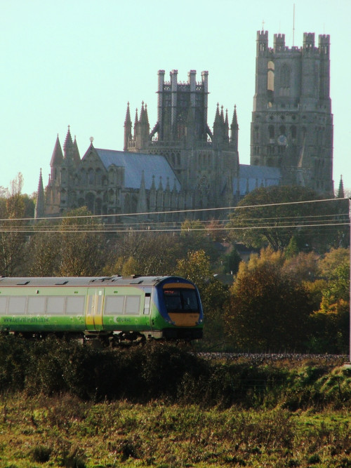
At the point the boat turns to make it's way upstream you can see the cathedral. Here it was seen on a bright November afternoon in 2005.
(After railway bridge:)
The recorded history of Ely can be traced back to the seventh century, when the Saxon Queen Etheldreda founded a religious community here. It was high on an island, overlooking the surrounding waterlogged and inhospitable fen. Today the successor to that community, the cathedral, dominates the city - and the fenland for miles around.
The city’s prosperity has always been linked to the cathedral, and to the productivity of the fenland, being both a market town and a tourist centre. That first sight of the cathedral across the flat fen must have been as impressive to the medieval pilgrim as it is today - to the modern coach party.
It’s ironic really, that it was during the ascendancy of Ely’s most famous resident, Oliver Cromwell, that the cathedral came closest to destruction. It was only saved because it was thought that the cost of demolition would be greater than the value of the materials which could be salvaged.
(Before turning:)
We’re heading downstream at the moment, and the river stretches away into the distance before us. Further on, the river Ouse reaches Denver Sluice, near Downham Market, where a lock allows access to the tidal river, down to the port of King’s Lynn and eventually to the Wash and the North Sea, about 30 miles from here. At Denver there are connections to the rest of the inland waterway network, and with a suitable boat - and enough time to spare - from here we could reach London, Bristol, Liverpool and Leeds.

©: Christine Johnstone (cc-by-sa/2.0)
Approaching the northern rail bridge from the north you can make out the buildings of the Ely waterfront under the bridge.
* * * * *
(After railway bridge)
The small public park on the right here provides valuable mooring space for some of the many boats that come to visit Ely during the summer months. Many of them of course will be fibreglass cabin cruisers, such as the many white boats that we’ll see later on during this cruise. But an increasing number of the visiting boats these days will be narrow boats. Like the name suggests, narrow boats are long and thin, and their steel hulls are painted black. They come in lengths of up to 70 feet, but are found only to be 7 feet wide. The reason for this is that the early artificial navigations of this country (the canals) were provided with locks that could only accommodate boats of that small size. So, if you’re cruising just locally, around the waterways of the Fens, where the locks are broad, you can have a wider boat to enjoy the extra space inside the cabins. But for cruising extensively over the rivers and canals of this country, a narrow boat is really what you need.

©: N Chadwick (cc-by-sa/2.0)
On the right is Ely's Pocket Park, as seen from the rail bridge. As Steve's commentary suggests, narrowboats are a far more common sight these days.
* * * * *
(After Lincoln bridge:)
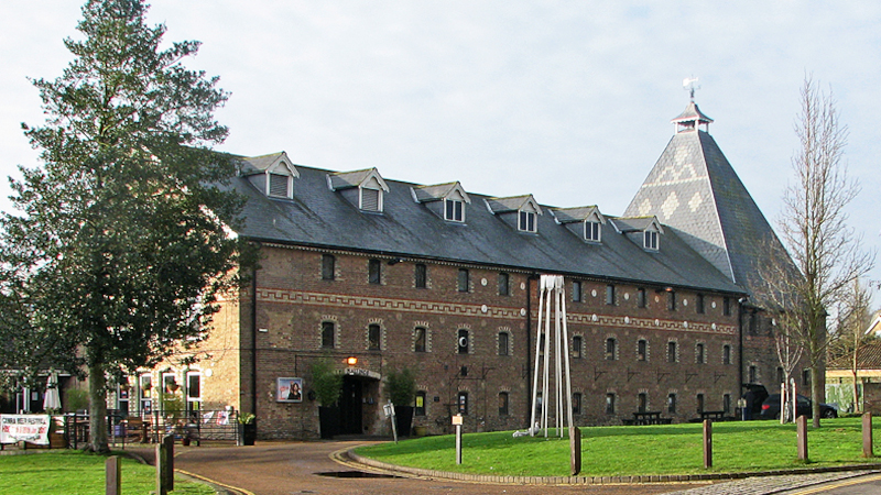
The large building away to the right here is The Maltings, and its presence here is a reminder of the how important the river used to be for trade, in times gone by. Built in 1868 for the purpose of malting barley as part of the beer-making process, the building had a working life of about 100 years before it fell into disuse. But it survived a fire, and soon after embarked upon a new career as a café, restaurant, and entertainment centre.
©: John Sutton (cc-by-sa/2.0)
The Maltings is just about the closest building to the starting point for a cruise aboard Liberty Belle.
Trade on the river was established here at least 800 years ago, and goods unloaded at the wharves, that had lined the right hand bank, had included imported cloth, as well as lead, iron and tin, canvas, wax and pottery.
A more up to date use for the river can be seen to the left here, in the form of Ely Marina. Dug out in the 1970s and 80s, it now provides berths for some two hundred pleasure craft. The marina is deservedly popular, being well-kept and convenient for the facilities of Ely, so that many owners treat their boats rather like a weekend cottage.
©: Christine Johnstone (cc-by-sa/2.0)
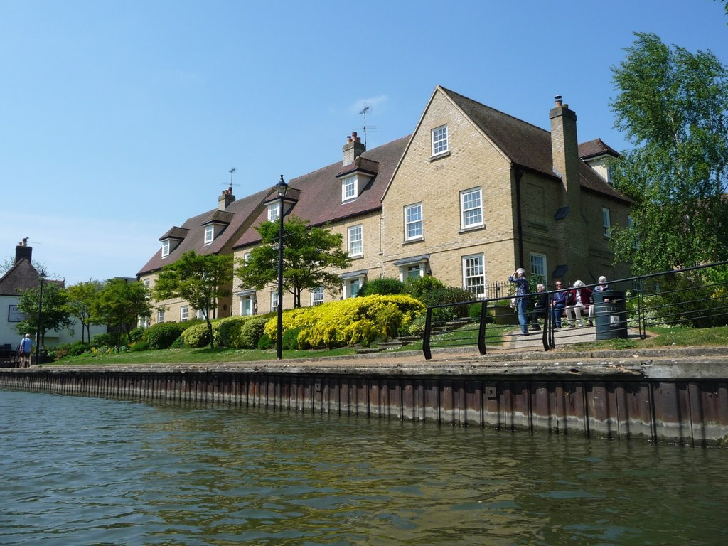
Jubilee Quay was certainly a prestigious development when it was built.
Close on the right hand side now is Jubilee Quay, a recently completed development of nine exclusive four and five bedroom town houses. They have French designer kitchens, and a jacuzzi bath in the main bedroom. The exteriors are Olde Ely brick in Flemish bond pattern, with traditional handmade tiles to the roof. With that upmarket specification, coupled to a fine view out over the river here, they weren’t going to be cheap, and prices started at £295,000.
(Optional:) The Inn on the right here was built in 1828 to provide refreshment and accommodation for a very different clientele. ‘Cutters’ were the men who were employed to dig - by hand - a new channel for the river between Adelaide and Littleport, to help reduce flooding. It seems a shame that those early patrons are not now depicted on the pub sign, which shows instead a type of sailing vessel.
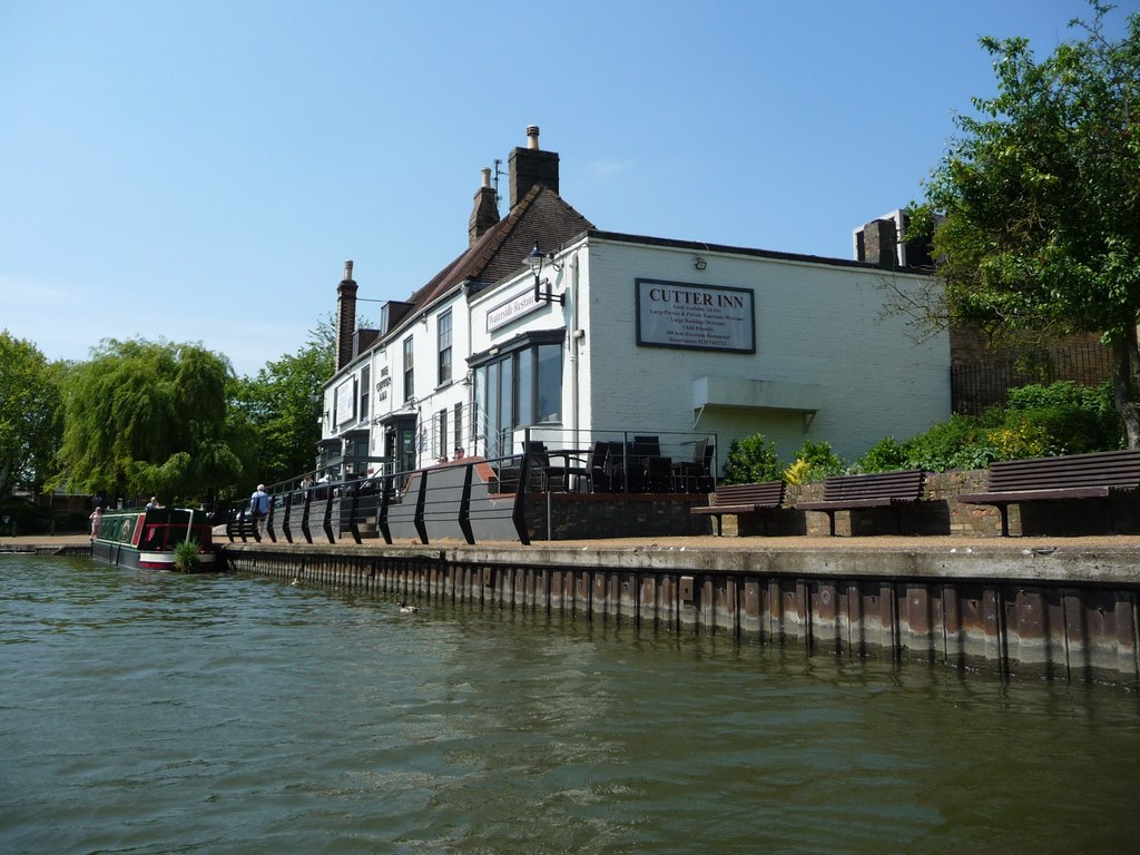
©: Christine Johnstone (cc-by-sa/2.0)
The Cutter Inn was a placed I twice performed at in my days touring the folk clubs of Norfolk and the surrounding counties back in the 1970s. On neither occasion did the club manage to pay my full fee of £25!
* * * * *
(After railway bridge:) To cruise the fenland waterways without the expense of buying a boat, many people these days choose to hire one. Narrow boats can be hired on the River Nene at March from Fox’s boatyard, and fibreglass cabin cruisers are available from Bridge Boats, here on our right hand side. You don’t need previous boating experience to hire a boat as tuition is given by the boatyard staff before you set off. Friday and Saturday are the popular departure days here, and on those particular days of the week in high summer, we can see the entire fleet of some 20 boats setting out with new hirers on board, looking forward to spending their holiday afloat.

©: Christine Johnstone (cc-by-sa/2.0)
I remember the days of pouring over the Blakes Catalogue in the 1960s. It specialised in hire boats on the Norfolk Broads, but there were always a handful of pages listing hire fleets in the Fens and Ely's Bridge Boat Yard was always one of those featured,
* * * * *
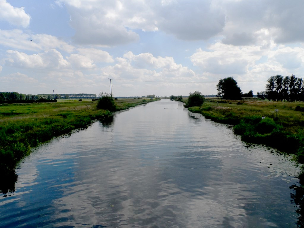
(After High Bridge:) Three miles ahead of us now, at a place called Pope’s Corner, the rivers Cam and Great Ouse have converged. We could continue from there along the river Ouse to reach Huntingdon, St Neots, and eventually, the head of navigation at Bedford, some 50 miles and 16 locks away. The riverside villages of the Ouse valley are some of the prettiest in the country, set amongst quiet backwaters and lush meadowlands, with several fine manor houses, and a number of preserved watermills.
©: Bikeboy (cc-by-sa/2.0)
Once south of the road bridge the river straightens and stretches ahead with less of obvious interest to a casual tourist so, here, Liberty Belle turns to return to the quay.
Branching left though at Pope’s Corner, the River Cam is navigable to Cambridge, a distance of 16 miles with 3 locks, and a journey time by boat of about 4 hours. These days, the Cam is used almost entirely for recreation - especially for cruising, rowing and fishing. Coarse fishing is extensive as the river supports brown trout, as well as roach, perch, pike and carp. Further upstream, punting is the traditional way to explore the part of the river known as the Backs, where The Cam flows past six historic and attractive riverside colleges, and is certainly at its scenic best - in the university city of Cambridge. (Ends)